
Luftvermessung
Flugplanung und Durchführung
Orientierung [GPS/IMU]
Bildflug
digitale Sensoren
RGBI, Thermal,Hyperspektral
LiDAR
Airborne Laserscanning
Flugplanung und Durchführung
Orientierung [GPS/IMU]
digitale Sensoren
RGBI, Thermal,Hyperspektral
Airborne Laserscanning
dient als Nachweis, daß ein Objekt nach einer gewissen Zeit nicht mehr in dem Zustand ist, wie zum Zeitpunkt der Beweissicherung.
im Rahmen eines laufenden Gerichtsverfahrens wird ein Sachverständiger mit der Erstattung eines Gutachtens beauftragt.
Der Sachverständige übernimmt durch die Festlegung im Schiedsgutachtervertrag die Erstellung eines Schiedsgutachtens.
Der DGuSV ist ein amtlich eingetragener Berufsverband und unterliegt damit einer erhöhten Sorgfaltspflicht gegenüber seinen Mitgliedern.
Durch langjährige Aktivitäten ist der DGuSV bestens positioniert und verfügt auch im Ausland über eine hohe Akzeptanz. Aufgrund seines breiten Leistungsspektrums gehört der DGuSV zu den Organisationen mit der höchsten Mitgliederzufriedenheit. Die Bundesgeschäftsstelle ist in Chemnitz zu finden, Büros gibt es außerdem in Berlin, in Sachsen und in Bayern.
In der Sachverständigenrolle des DGuSV werden nur Gutachter aufgenommen, die eine umfassende Prüfung durchlaufen haben. Die Qualitäts- und Zertifizierungsrichtlinien des DGuSV sind dabei sehr hoch angesiedelt und setzen neben der Eignung zur Erstellung von Gutachten auch überdurchschnittlichen Sachverstand voraus, der durch fundierte Belege nachzuweisen ist. Prüfung und Ernennung zum zertifizierten Sachverständigen des DGuSV erfolgen in Kooperation mit der Europäischen Wirtschaftlichen Vereinigung der Sachverständigen und der European Experts Group Ltd. auf EU-Ebene.

Wir unterliegen dem Verhaltenskodex des DGuSV [link]
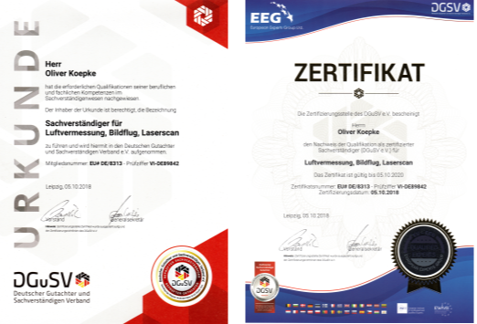
Wir arbeiten als Sachverständige für Luftvermessung, Bildflug und Airborne Laserscanning Technologien [LiDAR] zur Erfassung topographischer Systemdaten.
„Der Sachverständige ist eine unabhängige, integre Person, die auf einem oder mehreren bestimmten Gebieten über besondere Sachkunde sowie Erfahrung verfügt. Der Sachverständige trifft aufgrund eines Auftrages allgemeingültige Aussagen über einen ihm vorgelegten oder von ihm festgehaltenen Sachverhalt. Er besitzt ebenfalls die Fähigkeit, die Beurteilung dieses Sachverhaltes in Wort und Schrift nachvollziehbar darzustellen.“
[EuroExpert, European Organisation for Expert Associations]


Best AI Website Creator